General Information
| Languages : | English, Spanish |
| Currency : | US Dollar (USD) |
| Time Zone : | In addition to the usual EST, CST, MST, and PST, there are Alaskan Standard Time (AKST), Hawaii-Aleutian (HST), Samoa (EST -6hrs) and Chamorro (EST +15hrs). |
| Capital City : | Washington, DC |
| Population : | 301 Million |
| Government : | Constitution-based Federal Republic; strong Democratic tradition |
| Total Area : | 3,794,083 mi² |
| Climate : | Mostly temperate, but tropical in Hawaii and Florida, arctic in Alaska, semiarid in the great plains west of the Mississippi River, and arid in the Great Basin of the southwest; low winter temperatures in the northwest are ameliorated occasionally in January and February by warm Chinook winds from the eastern slopes of the Rocky Mountains |
| National Holidays: | Independence Day, 4 July |
| Additional Info: | One of the most dynamic countries, the United States of America (U.S.A.) offers a wide range of terrain, diverse cultures, vast cities and small friendly towns with something for everyone |
Destination Activities
»»» Check out Special Destination: Grand_Canyon
Activity Details
Introduction to USA
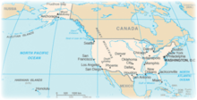
The coastal plain of the Atlantic seaboard gives way further inland to deciduous forests and the rolling hills of the Piedmont. The Appalachian Mountains divide the eastern seaboard from the Great Lakes and the grasslands of the Midwest. The Mississippi-Missouri River, the world's fourth longest river system, runs mainly north-south through the heart of the country. The flat, fertile prairie land of the Great Plains stretches to the west. The Rocky Mountains, at the western edge of the Great Plains, extend north to south across the continental United States, reaching altitudes higher than 14,000 feet in Colorado. The area to the west of the Rockies is dominated by deserts such as the Mojave and the rocky Great Basin. The Sierra Nevada range runs parallel to the Rockies, relatively close to the Pacific coast. At 20,320 ft, Alaska's Mount McKinley is the country's tallest peak. Active volcanoes are common throughout the Alexander and Aleutian Islands and the entire state of Hawaii is built upon tropical volcanic islands. The supervolcano underlying Yellowstone National Park in the Rockies is the continent's largest volcanic feature.
Because of the United States' large size and wide range of geographic features, nearly every type of climate is represented. The climate is temperate in most areas, tropical in Hawaii and southern Florida, polar in Alaska, semiarid in the Great Plains west of the 100th meridian, desert in the Southwest, Mediterranean in coastal California, and arid in the Great Basin. Extreme weather is not uncommon - the states bordering the Gulf of Mexico are prone to hurricanes and most of the world's tornadoes occur within the continental United States, primarily in the Midwest.
Scuba Diving
Scuba diving possibilities are almost endless in the United States - almost every state of the union offers some form of diving that could peak the interest of some kind of diver. We have started with some of the more popular sites although, as mentioned, this category is huge and we hope to see it expanded into a state-by-state guide.
» California
- Monterey Bay, south of San Francisco, is a great place to dive.The roughly semicircular bay is ringed by a segment of California State Route 1 which connects Santa Cruz at the north end to Monterey at the south end. The waters around this area are teeming with sea kelp forests and are home to an incredibly diverse marine ecosystem. If you are lucky, you might also run into sea mammals such as whales, sea otters, and sea lions. Monastery Beach and Stillwater Cove in Carmel; Bluefish and Whaler's Coves at Point Lobos; Monterey State, San Carlos and McAbee Beaches in Monterey are all popular beach dives.
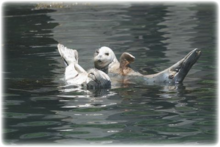
- Located approximately 20 to 80 miles offshore from the metropolis of Southern California are the underwater treasures called the Channel Islands. The Channel Islands, off from the coast of Santa Barbara and further South out from Los Angeles are another popular destination for diving in the southwest. Each island is a bit unique and offers a slightly different selection of marine life, bottom depths, bottom terrain, water visibility, and gaming opportunities. A great Island to check out is Santa Barbara Island. This is the home to hundreds of California Sea Lions and Harbor Seals and they often will become your dive buddies. Located here is Arch Reef, a huge submerged underwater archway in a rock wall that you can easily swim through. Lots of game fish, abalone, rock scallops and lobster make this island their home.
» Florida
Florida has some of the best diving in the US and for those living or visiting the south, it's your best bet for some really great opportunities.
- The Florida Keys. If you like shark diving, head down to Key West where you can join shark hunt tours on week long live aboard cruises - down here, you have the opportunity to find Lemon Sharks, Bull Sharks, Nurse Sharks, Hammerheads, Tiger Sharks, Reef Sharks, as wells as Loggerhead Turtles. If sharks aren't your cup of tea, but wreck diving is, head to Key Largo to see one of the largest artificial reefs - a Landing Ship that was sunk in 2002. And if you just like to explore the under water world, the Keys is still a great spot as it is home to North America's only living-coral barrier reef. This teeming backbone of marine life runs the length of the Keys about five miles offshore.
- Manatee Diving. Florida Manatees, large, fully-aquatic marine mammals sometimes known as sea cows, typically inhabit warm, shallow, coastal estuarine waters. The warm water in the Crystal River, 70 miles north of Tampa, attracts large numbers of manatees, and Kings Bay, at the head of the river and the location of 28 of the springs, harbors approximately 150 manatees during the winter. Some biologists consider Crystal River to be the most important refuge for manatees in the United States. They usually stay in one area when they are in the "morning mode" and can be approached quite easily. In the afternoon, when the sun is hot they stay mainly on the bottom or are on the move for food. Approaching the manatee when they are eating or on the move is prohibited by Florida law. Fines of up to $100,000.00 can be imposed for harassment. There are many dive outfitters in this area that will provide tours of the springs and great opportunities for manatee signings.
» Hawaii
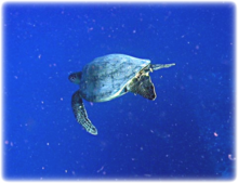
On a trip to Oahu in 2003, I experienced some of the finest diving of my life. Turtles resting on underwater wrecks, beautiful coral reefs, amazing sunken ships and the clearest bluest water, not to mention a fish spotter's dream. And this is just one of the islands to try.
Oahu: There are tones of dive shops and charters available here. When I went, we booked ours in advance because one person was getting certified (has to be one of the best places to do it) and another wanted to do an advanced certification. But by walking along the Oahu front, you will come across many options when you are there. Some dive sites are included here:
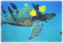
- YO-257/San Pedro - a decommissioned Navy ship - there are actually two wrecks in one on this dive, as long as the current is cooperating. Maximum depth is 100ft and fish and eels and large turtles are everywhere. There are large cut-outs all along the sides of the YO-257 that allow you to see the inside it. The San Pedro, which sits about 50 yards away, is a smaller, shallower and much more wrecked wreck. It is definitely of the falling-apart variety. Generally plenty of Hawaiian Green Sea Turtles cruising this one as well as a resident White Tip reef shark that tends to hang around nearby.
- Sea Tiger - With depths from 68ft to 122ft, this wreck is great for more than one dive. Peek in the cabins and cargo holds to find napping turtles and be on the lookout for a squadron of spotted eagle rays circling the wreck. Also keep an eye out for spotted Eagle Rays, and big octopus. Enjoy the swim-through's, but beware of penetration.
- Kewalo Pipe - Every variety of eel, clouds of reef fish, and resident frogfish. There is a lot of low growing reef here. You need to look down into the coral to see all the good stuff. Some Hawksbill turtles have been hanging here, and you can occasionally see a Manta Ray at this site. Max depth is 63ft.
The Big Island: The Big Island's Kohala Coast offers some of the best diving in the Hawaiian Islands. The water along the coast is clear year-round, often exceeding 100-foot visibility, with ocean temperatures ranging from 72 degrees in the winter to 80 degrees in the summer. The Kohala Coast is dominated by intricate lava flows, tunnels and crevices, and offers steep drop-offs close to shore, 150-foot lava tubes, tunnels, crevices, and the world's largest tiger cowries.
Kauai: Some of the most pristine and dramatic diving available takes place off the Forbidden Island of Ni'ihau, which lies 17.5 miles across the Kaulakahi Channel, southwest of Kauai. This spot has incredible wall dives, soaring lava formations, enormous caves, bountiful marine life and unlimited visibility, will dazzle even the most discriminating diver.
» North Carolina
When you think of wreck diving in the States, you come up with the coast off North Carolina. For the divers who visit them today, the wreck sites provide the foundation for a sensitive ecosystem of incredible diversity and beauty. Also known as the "Graveyard of the Atlantic", you'll find many types of sunken vessels from tugboats and barges to Civil War blockade runners to WWII U-boats.
There are literally thousands of wrecks dotting the coast line. Some popular wrecks are listed below:
- Indra. This former landing craft repair ship was sunk as part of an artificial reef program. The boat sits upright and intact in 65ft of water with the upper decks rising to 35ft, an excellent depth for beginner divers. The wreck is closer to shore and easier to get to than the majority of North Carolinas wrecks.
- Papoose. This tanker was sunk in 1942 by a German U-boat torpedo. Particular points of interest are the large rudder and the bow anchors. A good array of offshore NC marine life exists here as well as a fairly consistent source of large groups/schools of sandtiger sharks.
- U-352. A famous wreck, this U-boat was sunk by the Coast Guard Cutter Icarus. In 1942 the U-boat fired on the cutter and missed. In retaliation, Icarus fired back, killing 13 of the sub's crew. It surface, surrendered, and when all prisoners were aboard, Icarus sunk the sub. In 115 ft of water, the wreckage attracts bait fish seeking protection from predators. This is a pretty advanced dive.
Kayaking
Check back here soon for a fab piece of locals advice on kayaking in southeast United States.
Fishing
The US is a vast land with fishing opportunities in every state. We have started with some of the most well known destinations but hope to pad this out to all the best spots for a good day's angling.
» Alaska
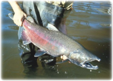
Alaska Salmon Fishing: Alaska is home to salmon runs so thick you can walk across their backs, halibut so big they're called barn doors, and bottom fish so plentiful, fishing for them is called "catching". Alaska's fishing bounty is so rich it continues to feed a hungry world.
The Kenai River, in the Kenai Peninsula of south central Alaska, runs 82 miles westward from Kenai Lake in the Kenai Mountains to its outlet into the Cook Inlet of the Pacific Ocean near Kenai. The Kenai River is the most popular sport fishing destination in Alaska. Each year there are two runs each of king salmon, silver salmon, red salmon, plus a run of pink salmon every other year. The world record king salmon, which weighed about 97lb, was caught in the Kenai River in 1985. The king salmon fishery is not as prolific as in other Alaskan rivers, but the Kenai is known for its large fish. A typical king in the second run, beginning in mid-July, weighs 40 to 50 pounds, with considerably larger specimens not uncommon. The "Lower Kenai" is notorious for its run and sizes of its king salmon. The silver salmon runs occur in early August and late September. The September run is favored by local anglers due to the larger size of the silver salmon. The red salmon runs are in mid-June (bluebacks) and mid-July. Reds are considered the premier salmon for eating, canning, and smoking.
Along with Kenai's fish, the Kenai River area is home to other wildlife, including moose, bears, and multiple species of birds. In the spring, Beluga whales will travel as far as a mile upstream from the mouth of the river to feed on schools of spawning Hooligan fish.
» Florida
Lake Fishing - Lake Okeechobee is a freshwater lake well known for its amazing bass fishing, and has produced the best largemouth bass, blue gill and speck fishing in the world. It is the second largest freshwater lake in the United States. The 730-square-mile lake is located in south central Florida. It is shallow (average depth 9 feet) and provides an ideal habitat for bass. It is a fisherman's paradise. You can expect to tangle with 7-10 pound bass. The lake record is 15 pounds 5 ounces. While fishing is very good year-round it is particularly spectacular during spawning season. Lake Okeechobee has a number of famous fishing areas including the Monkey Box, Moonshine Bay, Fisheating Creek, Hay Fields, and the Cow Pasture.
Florida is also a great spot in the US to try out deep sea and/or sport fishing. One popular destination for deep sea is Cape Canaveral, in Brevard County, near the center of Florida's Atlantic coast, 45 minutes East of Orlando by car. There are more than a dozen species of fish that frequent this area, including: Dolphin (Mahi-Mahi), Barracuda, Wahoo, Sharks, King Mackerel, Sailfish, Tripletail, Blue Marlin, Grouper, and Tuna. In Port Canaveral track down a fishing charter company - expect to pay $400-$650 (2007 prices) depending on group size and half or full day. There are different times to try your hand at this fishing, depending on what you want to catch: deepwater bottom fishing for Grouper and Snapper exists year round; Blackfin Tuna and Sailfish are most prevalent during fall and winter; spring and summer offer runs of Cobia, Dolphin, King Mackerel and Wahoo; during the heat of the Summer (Late July-September), you can find some of the best Lobster diving to be found ("Average" Canaveral Lobsters weigh-in at 4-6 lbs with many weighing in at 10-12 lbs).
» Maine
Maine - To its south and east is the Atlantic Ocean, and to the north and northeast is New Brunswick, a province of Canada. It is well known for its dramatic ocean scenery, with almost 3,500 miles of shoreline. The state is a popular destination for sport hunting, sport fishing, snowmobiling, skiing, boating, camping and hiking, among other activities. Maine has a reputation for having one of the best saltwater sport fisheries on the east coast. Groundfishing is commonly referred to as Deep Sea Fishing. Fishing for groundfish in Maine consists of Cod, Pollock, Haddock, Cusk, Wolffish, Redfish and a variety of other species. Several trips in the last few years have landed nearly 400 pounds of assorted groundfish. Up to 30 miles offshore, blue sharks 6 to 12 feet in length are the common shark catch. Very rarely would you return without tagging and releasing several blue sharks. Occasionally a porbeagle, thresher or mako shark is hooked up. Nearer the coast, Mackerel are quite plentiful from late May to November, as long as the Bluefish are not around. Striped Bass, or "Stripers", start showing up in early May, as small fish under five pounds. Bluefish are ferocious fighters with razor sharp teeth that have been showing up around the first of July. They are known for their unbelievable fight.
Maine has also been long renowned for its freshwater fishery as well. The lakes region of Maine offers anglers many different opportunities to fish for a variety of species. The clean, deep beautiful lakes and ponds are home to sport fish such as salmon, brook trout, lake trout, largemouth bass, smallmouth bass, pike and other species.
» Michigan
Bounded by four of the five Great Lakes (Erie, Michigan, Superior and Huron), plus Lake Saint Clair, Michigan has the longest freshwater shoreline in the World, and the second longest total shoreline in the United States. Lake trout, brown trout, walleye, salmon, steelhead and bass - some of the fish populating the Great Lakes and the 11,000 inland lakes and streams.
For example, try out the fishing at Pere Marquette River - a famous Steelhead, Salmon, and Brown Trout river. From September to March, Steelhead run up into the river from its mouth at Ludington, a small town a little more than halfway up Lake Michigan's eastern shore. Chinook enter the system in August and continue into October. Browns and Rainbows are the mainstays of the river. Angling methods: spin, and fly-fishing.
Boardman River - this could be the finest wild trout stream in Michigan. Cold and clear and rising in a swamp of mixed cedar, pine, and hardwood, the Boardman has earned a reputation as a small, fine trout stream. Nowhere is this river really wide enough to fish from a drift boat, though armies of canoeists ease their way along its bucolic course on the hot weekends of summer. But, for the large part, they leave the river alone during the week, and in fall, when fishing can be spectacular, they are all but gone. Species: Brown, brook. Angling methods: spin, and fly-fishing.
Or head to Lake Michigan for sport fishing for Trout and Salmon. Fishing Lake Michigan provides some of the best fishing for Steelhead, Coho Salmon, Perch, Chinook Salmon, Rainbow Trout, Lake Trout, Brown Trout, Smallmouth Bass, Largemouth Bass and Walleye in the Midwest. There are more than a hundred cities and towns on Lake Michigan's banks. There are dozens of tributary creeks, streams and rivers that provide excellent fishing. Access areas for fishing the Lake Michigan Shore include: harbors, piers, breakwalls, power plants, city parks, river mouths and scenic shorelines.
» Oregon
Oregon's geography may be split roughly into seven areas: Oregon Coast - west of the Coast Range, Willamette Valley, Rogue Valley, Cascade Mountains, Klamath Mountains, Columbia River Plateau, and Basin and Range Region.
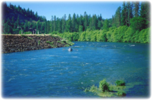
The Rogue River is a river located in the southwest of Oregon, flowing from the Cascade Range to the Pacific Ocean. Here you can combine rafting and fishing in a beautiful forest environment. Fish you can expect to catch are the Salmon, Chinook and Steelhead. The Rogue river features exceptional fishing, abundant wildlife, incredible scenery and rich history. Recognized as salmon and steelhead paradise, the Rogue provides anglers with idyllic pools and quiet fishing holes that teem with fish journeying upriver from the nearby Pacific Ocean. In the fall, Steelhead range from 1 to 2 foot long and weigh up to 8lbs. Chinook (king) salmon up to 40 pounds are also caught. And, the smaller silver (Coho) Salmon up to 12 pounds ply these waters.
To try out the deep sea fishing off Oregon's coast, head there from July to October when the deep blue waters of the tuna grounds are filled with exotic marine life. Experience Albacore fishing up to 100 miles off shore. When in season, you can also fish for halibut at Chicken Ranch, High Spot, Halibut Hill, the Saddle and Robbie's Hole just to name a few places.
Sturgeon fishing - there are two different kinds of Sturgeon fishing on the Columbia River: Keeper size and Trophy size fish. Keeper Sturgeon Begins in February and is very good through the middle of May, then is very good again in October and November. Trophy Sturgeon Fishing for the bigger "trophy sturgeon" begins mid-May and is very good through mid-August. These fish are massive, averaging 250-300lbs, and acrobatic, about half of the fish hooked will jump completely out of the water. Depending on the fish and the angler it can take between 20 minutes and 1 hour to land these fish.
Ecotourism
Yosemite National Park
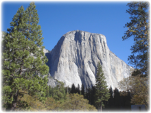
Yosemite National Park is a national park located largely in Mariposa and Tuolumne Counties, California. It takes 3.5 hours to drive to the park from San Francisco and about 6 hours from Los Angeles. Yosemite is surrounded by wilderness areas: the Ansel Adams Wilderness to the southeast, the Hoover Wilderness to the northeast, and the Emigrant Wilderness to the north. Yosemite is internationally recognized for its spectacular granite cliffs, waterfalls, clear streams, Giant Sequoia groves, and biological diversity. The park has an elevation range from 2,000 to 13,114ft and contains five major vegetation zones: chaparral/oak woodland, lower montane, upper montane, subalpine, and alpine. Of California's 7,000 plant species, about 50% occur in the Sierra Nevada and more than 20% within Yosemite.
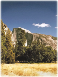
Yosemite Valley represents only one percent of the park area, but this is where most visitors arrive and stay. El Capitan, a prominent granite cliff that looms over the valley, is one of the most popular rock climbing destinations in the world because of its diverse range of climbing routes in addition to its year-round accessibility. Granite domes such as Sentinel Rock and Half Dome rise 3,000ft and 4,800ft, respectively, above the valley floor.
The high country of Yosemite contains beautiful areas such as Tuolumne Meadows, Dana Meadows, the Clark Range, the Cathedral Range, and the Kuna Crest. The Sierra crest and the Pacific Crest Trail run through Yosemite, with peaks of red metamorphic rock, such as Mount Dana and Mount Gibbs, and granite peaks, such as Mount Conness. Mount Lyell is the highest point in the park.
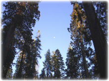
The park has three groves of ancient Giant Sequoia trees; the Mariposa Grove (200 trees), the Tuolumne Grove (25 trees), and the Merced Grove (20 trees). Giant Sequoia are the most massive trees in the world and are one of the tallest and longest-lived.
Yosemite Valley is open year-round, but much of the remaining park is closed due to snow in late fall and does not re-open until mid to late spring. Many people enjoy short walks and longer hikes to waterfalls in Yosemite Valley, or walks amongst Giant Sequoias in the Mariposa, Tuolumne, or Merced Groves. Others like to drive or take a tour bus to Glacier Point (summer-fall) to see a spectacular view of Yosemite Valley and the high country, or drive along the scenic Tioga Road to Tuolumne Meadows (summer-fall) and go for a walk or hike.
The Florida Everglades
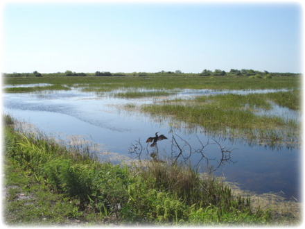
The Florida Everglades are subtropical marshland located in the southern portion of the U.S. state of Florida, specifically in parts of Monroe, Collier, Palm Beach, Miami-Dade, and Broward counties. Water leaving Lake Okeechobee in the wet season forms the Everglades, a shallow, slow-moving flood at one time 40 miles wide and over 100 miles long moving southward across a nearly flat limestone shelf to Florida Bay at the southern end of the state.
The only highway access is the State Road 9336, running 47 miles from Florida City to the coast at Flamingo. There have been recent expansions to the park's tourist facilities to bring in more money to Florida's economy such as a massive extension to the visiting center, many outposts along the bridges that span the Everglades that teach people about the many birds and other wildlife native to the Everglades as well as a small petting zoo.
The area boasts rare and endangered species, such as the American crocodile, Florida panther, and West Indian manatee. It has been designated an International Biosphere Reserve, a World Heritage Site, and a Wetland of International Importance, in recognition of its significance to all the people of the world. Spend a morning fishing the flats, an afternoon hiking among alligators, taking a tour with a ranger or spending an evening enjoying the warmth of your campfire.
Hawaii
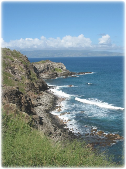
Hawaii is an excellent ecotourism destination with a great emphasis on exploring the environment and learning about the rich Polynesian past. Archaeological sites abound around the islands, in particular on the Big Island of Hawaii and Kauai where ancient temples, petroglyphs and local lore are strong. Both islands are exceptional destinations for exploring the natural environment with hundreds of miles of State Park trails and sea kayaking and hiking in Kauai and exploring Volcano National Park on the Big Island being major attractions.
» Big Island (Hawaii) - a volcanic island in the Pacific Ocean. The Big Island is famous for its volcanoes. Kilauea, the most active, has been erupting almost continuously for more than two decades. The Island of Hawaii is built from five separate shield volcanoes that erupted somewhat sequentially, one overlapping the other. These are (from oldest to youngest): Kohala (extinct), Mauna Kea (dormant), Hualalai (dormant), Mauna Loa (active, partly within Hawaii Volcanoes National Park), and Kilauea (very active; part of Hawaii Volcanoes National Park). Because Mauna Loa and Kilauea are active volcanoes, the island of Hawaii is still growing. Akaka Falls State Park is a state park in Hawaii, located 11 miles north from Hilo (at the end of Highway 220). It includes Akaka Falls, a 442 ft. tall waterfall. The accessible portion of the park lies high on the right shoulder of the deep gorge into which the waterfall plunges, and the falls can be viewed from several points along a loop trail through the park.
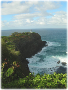
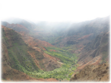
» Kauai - the oldest of the main Hawaiian Islands. Known also as the "Garden Isle", Kauai lies 105 miles across the Kauai Channel, northwest of Oahu. Of volcanic origin, the highest peak on this mountainous island is Kawaikini at 5,243ft. The second highest peak is Mount Waialeale near the center of the island, 5,148 ft above sea level. One of the wettest spots on Earth, with an annual average rainfall of 460 inches, is located on the east side of Mount Waialeale. The high annual rainfall has eroded deep valleys in the central mountains, carving out canyons with many scenic waterfalls. The Alakai Wilderness Area, also popularly known as Alakai Swamp, is a high plateau rainforest, not a true swamp. It is located on the Hawaiian island of Kauai, and rests near Mount Waialeale. The Alakai Swamp trail (3.5 miles long) is often shrouded in mist. You can reach this trail via the Pihea Vista trail which connects from the PuÊ»u o Kila lookout that is on Waimea Canyon road in KauaÊ»i.
Hiking
Hiking Yosemite National Park:
Over 800 miles of trails are available to hikers at Yosemite - anything from the easy stroll, to the grueling hikes up several park mountains, to multiple-day backpack trips. The park can be divided into 5 sections for the day-user-Yosemite Valley, Wawona/Mariposa Grove/ Glacier Point, Tuolumne Meadows, Hetch Hetchy, and Crane Flat/White Wolf. Numerous books describe park trails, and free information is available from the Park Service in Yosemite. Most park workers strongly encourage guests to experience portions of the park other than Yosemite Valley. Between late spring and early fall, much of the park is open to multiple-day backpack trips. All overnight trips into the back country require a wilderness permit and most require approved bear-resistant food storage.
The John Muir Trail (JMT) is a long-distance trail in the Sierra Nevada mountain range of California, running 211 miles from the Happy Isles trailhead in Yosemite Valley south to the summit of Mt. Whitney on the border of Sequoia National Park and Inyo National Forest. For about 160 miles, the trail follows the same footpath as the much longer Pacific Crest Trail. It is named for naturalist John Muir. From its northern terminus in Yosemite Valley, the trail runs northeast to Tuolomne Meadows, passing near Half Dome, then, running parallel to the main range of the Sierra Nevada, southeast through Yosemite National Park, Inyo and Sierra national forests (including the John Muir and Ansel Adams wilderness areas), Devils Postpile National Monument, Kings Canyon National Park, and Sequoia National Park.
McGurk Meadow, Bridalveil Creek, and Dewey Point (accessed via Glacier Point Road): Bridalveil Creek: 4 miles round-trip; 2 to 3 hours, Dewey Point: 7 miles round-trip; 3 to 4 hours. Begin at McGurk Meadow trailhead (0.2 miles west of Bridalveil Creek Campground turnoff). The trail leads downhill 0.8 miles to McGurk Meadow and the site of an old cabin that belonged to John McGurk. One mile beyond the cabin are trails west to Dewey Point and east to Bridalveil Creek. During July, the meadows in this area are a great place to see wildflowers.
In the Hetch Hetchy part of Yosemite, try a 5 mile hike to Wapama Falls (5 miles round trip). Begin at O'Shaughnessy Dam. This trail takes you to the base of Wapama Falls, passing two smaller waterfalls (during spring) on the way.
Trekking - National Scenic Trails
There are several long distance hiking trails in the US. Perhaps the most famous is the Appalachian National Scenic Trail which travels down the east coast from Maine to Georgia. Others include the Pacific Crest National Scenic Trail, Continental Divide National Scenic Trail, North Country National Scenic Trail, Ice Age National Scenic Trail, Florida National Scenic Trail, Potomac Heritage National Scenic Trail, and the Natchez Trace National Scenic Trail.
» Appalachian National Scenic Trail
The Appalachian Trail (AT) is a 2,175-mile long footpath stretching through 14 eastern states from Maine to Georgia. It traverses the wild, scenic, wooded, pastoral, and culturally significant lands of the Appalachian Mountains. It extends between Springer Mountain in Georgia and Mount Katahdin in Maine. The Appalachian Trail is famous for its many hikers, many of whom attempt to trek it in its entirety, often non-stop. The American black bear is the largest omnivore that would be encountered on the trail, and it inhabits all parts.[9] However, bear sightings are rare, and hiker incidents still rarer, as black bears typically avoid humans and can usually be frightened away by making loud noise.
As the Appalachian Trail was explicitly designed to be hiked, it includes resources to facilitate hikers. Some are common to trails throughout North America, while some are unique to the Appalachian Trail. The trail is much more frequently hiked south to north (i.e. Georgia to Maine) than vice versa. Hikers typically begin in March or April and finish in late summer or early to late fall of that particular year. Many hikers will break down the mileage into halves or thirds, so that they can have the best weather, which typically occurs between May and September.
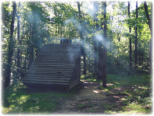
The trail has more than 200 shelters and camp sites available for hikers. The shelters, sometimes called lean-tos (in Maine) or huts (in New Hampshire), are generally open, three-walled structures with a wooden floor, although some shelters are much more complex in structure. Shelters are spaced less than a day's hike apart, most often near a water source and with a privy. They generally have spaces for tent sites in the vicinity, as well. It is always advisable to carry a tent when overnighting on the trail, since shelters may be filled to capacity, especially early in the season, and where they occur near parks. Trail hikers who attempt to complete the entire trail in a single season are called "thru-hikers"; those who traverse the trail during a series of separate trips are known as "section-hikers". The Appalachian Trail Conservancy gives the name "2000 Miler" to anyone who completes the entire Trail.
» Pacific Crest National Scenic Trail
The Pacific Crest National Scenic Trail is a long-distance mountain hiking trail that runs from the US border with Mexico to its border with Canada and follows the highest portion of the Sierra Nevada and Cascade Range which parallel the Pacific Ocean by 100 to 150 miles. The Pacific Crest Trail is 2,650 miles long and ranges in elevation from just above sea level at the Oregon-Washington border to 13,153 feet at Forester Pass in the Sierra Nevadas. The complete trip usually takes between four and six months. Around 180 complete the hike each year. Most thru-hikers start from the Mexican border and reach the north end of the trail before the first hard snow. Picking up supplies along the way, usually packages sent to them via mail, most hikers cover about 20 miles per day.
» Continental Divide National Scenic Trail
This trail runs 3,100 miles between Mexico and Canada. It follows the Continental Divide along the Rocky Mountains and traverses five U.S. states - Montana, Idaho, Wyoming, Colorado, and New Mexico. In Montana it crosses Triple Divide Peak which separates the Hudson Bay, Atlantic Ocean and Pacific Ocean drainages. Only about two dozen people a year attempt to hike the entire trail, taking about six months to complete it. This trail can be continued above the Canadian border to Kakwa Lake north of Jasper National Park by the Great Divide Trail, which is so far described only in a few books, and carries no official Canadian status.
» North Country National Scenic Trail
One-day this trail will stretch more than 4,600 miles from Crown Point in eastern New York to Lake Sakakawea in western North Dakota, but is, even now, the longest of the eight National Scenic Trails. Passing through the seven states of New York, Pennsylvania, Ohio, Michigan, Wisconsin, Minnesota and North Dakota, this trail connects more than 160 public land units, including parks, forests, scenic attractions, wildlife refuges, game areas, and historic sites.
» Ice Age Trail
The Ice Age Trail is a designated National Scenic Trail in the United States that will run some 1,200 miles through the state of Wisconsin. As of 2003, some 1000 miles of trail are completed. The trail wanders through the state following the southernmost location of the last continental glaciation. The western end of the trail is at Interstate Park. The eastern end is at Sturgeon Bay.
» Florida National Scenic Trail
The Florida Trail is a 1,400-mile footpath spanning from Big Cypress National Preserve (between Miami and Naples, Florida along the Tamiami Trail) to Fort Pickens at Gulf Islands National Seashore, Pensacola Beach. Like many other National Scenic Trails, the Florida Trail has been built in disconnected segments, created in a corridor where public land (or easements granted by private individuals) is available to route the trail.
» Potomac Heritage National Scenic Trail
This is a designated National Scenic Trail corridor that will connect various trails and historic sites through the states of Virginia, Maryland, Pennsylvania and the District of Columbia. When completed, the proposed 704-mile trail will trace the outstanding natural and cultural features of the Potomac River Basin.
» Natchez Trace Trail
The Natchez Trace Trail currently runs some 440 miles along the Natchez Trace Parkway through the states of Tennessee, Alabama, and Mississippi. Currently, 62 miles of the Natchez Trace National Scenic Trail are open for use in four areas along the Natchez Trace Parkway. The Parkway commemorates the historic Natchez Trace, an ancient path that began as a Native American trail and has a rich history of use by explorers, "Kaintuck" boatmen, post riders, and military men.
Cultural Activities
» Washington DC
Washington, D.C. is the capital of the United States. It is situated within and coterminous with the District of Columbia. The city and the district are located on the banks of the Potomac River and bordered by the states of Virginia (to the west) and Maryland (to the north, east and south). The city was planned and developed in the late 18th century to serve as the permanent national capital; the federal district was formed to keep the national capital distinct from the states. A center of American history and culture, Washington is a popular destination for tourists, the site of numerous national landmarks and monuments, the world's largest museum complex (the Smithsonian Institution), galleries, universities, cathedrals, performing arts centers and institutions, and native music scenes.
- The National Mall is an open-area national park in downtown Washington, D.C., the capital of the United States. However, the term commonly includes the areas that are officially part of West Potomac Park and Constitution Gardens to the west, and often is taken to refer to the entire area between the Lincoln Memorial and the Capitol, with the Washington Monument providing a division slightly west of the center. The Lincoln Memorial is a US Presidential memorial built to honor 16th President Abraham Lincoln. The architect was Henry Bacon, the sculptor was Daniel Chester French, and the painter of the interior murals was Jules Guerin.
- The National World War II Memorial is a National Memorial to all Americans that served in the armed forces and on the home front during World War II. It is located on the National Mall., on the former site of the Rainbow Pool at the eastern end of the Reflecting Pool, between the Lincoln Memorial and the Washington Monument.
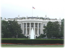
- The White House is the official home and principal workplace of the President of the United States of America. Built in 1800 of white-painted Aquia sandstone in the late Georgian style, it has been the executive residence of every U.S. President since John Adams. The house has been modified many times; from being set ablaze by British troops in 1814, to its rebuilding and recent Clinton administration renovation. In September 2003 daily public tours were resumed (after being suspended after the terrorist attacks on September 11th, 2001) on a limited basis for groups making prior arrangements through their Congressional representatives and submitting to background checks, but the White House remains closed to the general public.
- The Vietnam Veterans Memorial is a national war memorial that honors members of the U.S. armed forces who had died in service or are unaccounted for during the Vietnam War. The Memorial currently consists of three separate parts: the Three Soldiers statue, the Vietnam Women's Memorial, and the Vietnam Veterans Memorial Wall, which is the most recognized part of the memorial.
- The Smithsonian Institution is an educational and research institute and associated museum complex, administered and funded by the government of the United States and by funds from its endowment, contributions, and profits from its shops and its magazine. The Smithsonian is a collection of free museums that includes the Anacostia Museum, Arthur M. Sackler Gallery, Hirshhorn Museum, National Air and Space Museum, National Museum of American History, National Museum of the American Indian, National Museum of Natural History, National Portrait Gallery, National Postal Museum, Smithsonian American Art Museum, Renwick Gallery and National Zoo.
- The Library of Congress and the National Archives house thousands of documents covering every period in American history. Some of the more notable documents in the National Archives include the Declaration of Independence, Constitution and Bill of Rights.
- Now that the FBI doesn't allow tours of their facilities anymore, for some fun, head to the International Spy Museum, a privately owned museum dedicated to the field of espionage located in the Penn Quarter neighborhood of Washington, D.C., and one block west of the Gallery Place-Chinatown Metro station. Despite being one of the few museums in Washington that charges admission fees, it has been immensely popular since its opening in July 2002. Most of the exhibit areas bring visitors into the era's espionage environment. Numerous visitor-interactive stations are located throughout the exhibit areas. At the terminus of the exhibit area an 8-minute feature film updates and describes how modern technology has changed the face of warfare and terrorism.
» New York City
New York City) is the largest city in the state of New York and the largest city in the United States. It ranks among the largest urban areas in the world. For more than a century, it has been one of the world's major centers of commerce and finance. New York City comprises five boroughs, each of which is coterminous with a county: The Bronx, Brooklyn, Manhattan, Queens and Staten Island.
Architecture:
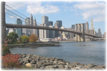
The building form most closely associated with New York City is the skyscraper that saw New York buildings shift from the low-scale European tradition to the vertical rise of business districts. New York City has about 4,493 skyscrapers, more than any other city in the world. Surrounded mostly by water, the city's residential density and high real estate values in commercial districts saw the city amass the largest collection of individual, free-standing office and residential towers in the world.
New York has architecturally significant buildings in a wide range of styles.
These include the Woolworth Building (1913), an early gothic revival skyscraper built with massively scaled gothic detailing able to be read from street level several hundred feet below.
Midtown Manhattan is the largest central business district in the world, and also home to such notable buildings as the Empire State Building, the Chrysler Building, Citigroup Center and Rockefeller Center.
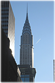
The Art Deco design of the Chrysler Building (1930), with its tapered top and steel spire, reflected the zoning requirements. The building is considered by many historians and architects to be New York's finest building, with its distinctive ornamentation such as replicas at the corners of the 61st floor of the 1928 Chrysler eagle hood ornaments and V-shaped lighting inserts capped by a steel spire at the tower's crown.
Things to see and do:
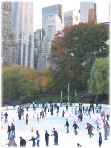
- Manhattan's Central Park, designed by Frederick Law Olmsted and Calvert Vaux, is the most visited city park in the United States. While much of the park looks natural, it is in fact almost entirely landscaped. It contains several natural-seeming lakes and ponds, extensive walking tracks, two ice-skating rinks, the Central Park Zoo, the Central Park Conservatory Garden, a wildlife sanctuary, a large area of natural woods, a 106 acre billion gallon reservoir, an outdoor amphitheater which hosts the Shakespeare in the Park summer festival, and grassy areas used for informal or team sports or set aside as quiet areas, as well as playground enclosures for children.
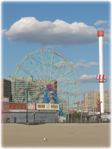
- Coney Island is a peninsula, formerly an island, in southernmost Brooklyn, with a beach on the Atlantic Ocean. The area was a major resort and site of amusement parks that reached its peak in the early 20th century. It declined in popularity after World War II and endured years of neglect. In recent years, the area has been revitalized by the opening of KeySpan Park, home to the successful Brooklyn Cyclones minor league baseball team.
- Broadway theatre is the most well known form of professional theatre to the American general public and most lucrative for the performers, technicians and others involved in putting on the shows. A Broadway show, usually a play or musical, is presented in one of the thirty-nine large professional theatres with 500 seats or more located in the Theatre District of the New York City borough of Manhattan.
- Greenwich Village, also called simply the Village, is a largely residential area on the west side of downtown (southern) Manhattan in New York City named after Greenwich, London. Today Greenwich Village is a cosmopolitan neighborhood north of Lower Manhattan, home to celebrities and many young adults.
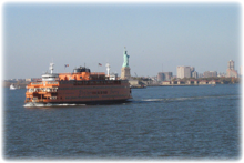
- Staten Island is the most suburban in character of the five boroughs. It is connected to Brooklyn by the Verrazano-Narrows Bridge and to Manhattan via the free Staten Island Ferry. The free ferry ride is a great 2 hours break from the city and goes past the Statue of Liberty.
- The Statue of Liberty is a large statue that was presented to the United States by France in 1886. It stands at Liberty Island in New York Harbor as a welcome to all visitors, immigrants, and returning Americans. The statue is of a female figure standing upright, dressed in a robe and a seven point spiked rays representing a nimbus (halo), holding a stone tablet close to her body in her left hand and a flaming torch high in her right hand. The tablet bears the words "JULY IV MDCCLXXVI" (July 4, 1776), commemorating the date of the United States Declaration of Independence. Liberty Island is again open to the public after it closed due to September 11, 2001, but the statue is no longer open for tourists to visit. The museum and ten-story pedestal are open for visitation but are only accessible if visitors have a "Monument Access Pass" which is a reservation that visitors must make at least two days in advance of their visit and pick up before boarding the ferry. There are a maximum of 3000 passes available each day (with a total of 15000 visitors to the island daily). The interior of the statue remains closed, although a glass ceiling in the pedestal allows for views of Eiffel's iron framework.
Biking
Cycling is a popular pastime around the United States, although in some areas more than others.
» The Adventure Cycling Association Atlantic Coast Bicycle Route is divided into two segments. The route is a total of 2,535 miles that hugs the Atlantic coast of the United States for roughly 60% of its length, heading inland to avoid major metropolitan areas and where cycling conditions along the coast are not favorable. In the Northeast, riders enjoy the flavor of quiet Maine coastal towns, New England villages, the rural countryside, and bucolic Amish farmlands. Once the route crosses the Mason-Dixon Line, which is the boundary between Pennsylvania and Maryland, the route ride enters the South and get some flavor for Civil War history by visiting the battlefields at Fredericksburg, Virginia, and the city of Richmond, Virginia. Spurs lead into the various larger cities along this route. A lack of road signs can make parts of this route challenging. It can be ridden from late spring to late fall. Due to changing local conditions, it is difficult to predict any major wind patterns. Unless riders are adapted to it, humidity will be a challenging factor.
» The Mount Vernon Trail is a popular running and bike path in Northern Virginia that runs from near Theodore Roosevelt Island to Mount Vernon. The path runs through parts of Arlington and Alexandria. The trail runs a similar path as the southern portion of the George Washington Parkway. The northern portion of the trail has scenic views of Washington D.C. from the south bank of the Potomac River, before arriving at Ronald Reagan National Airport.
» The American Tobacco Trail (ATT) is a 22-mile long Rails-to-Trails project located in the Research Triangle region of North Carolina, running along an abandoned railroad bed originally built for the American Tobacco Company in the 1970s. The route crosses through the City of Durham, Durham County, Chatham County, and Wake County. The ATT is part of the East Coast Greenway and is open to pedestrians, cyclists, equestrians (in non-urban sections), and other non-motorized users.
» U.S. Bicycle Route 1 is a cross-country bicycle route that runs the length of the United States eastern seaboard from Florida to Maine. It is one of the two original U.S. Bicycle Routes, the other being U.S. Bicycle Route 76. Only the North Carolina to Virginia part is recognized as being officially parts of this route.
» U.S. Bicycle Route 76 is a cross-country bicycle route east of the Mississippi River. It runs from the midwestern state of Illinois to the eastern seaboard state of Virginia. It is also known as the TransAmerica Trail.
Mountain Biking
» The Great Divide Mountain Bike Route is a bicycle route especially designed for mountain biking. It traverses a portion of the Rocky Mountains of North America, stretching from Banff, Alberta, Canada to Antelope Wells, New Mexico on the border with Mexico. The Great Divide Route is the mountain biking version that parallels the Continental Divide Trail (hiking). Occasionally they will intersect and share sections.
The Great Divide Mountain Bike Route was put together by Adventure Cycling and is the longest off-pavement bike route in the world. The route is generally ridden North to South crossing the continental divide a total of 30 times. Originally its total length was 2,490 miles. Adventure Cycling recently added a Section 0 which starts in Banff, Alberta, Canada and goes to the original route's starting point at Roosville, Montana; this adds another 220 miles to the route. Its highest altitude is around 11,910 feet above sea level at Indiana Pass in Colorado.
The route is the longest and most challenging off road bicycle tour in the world. It is a "Holy Grail" of the mountain bike world. The route begins in the southern Canadian Rockies, passes through the heavily forested Rockies of Montana and Idaho, meanders down into the barren desert lands of Wyoming's Great Basin, ascends again up and over several 10,000 to 12,000 foot passes in Colorado, and switch backs through rugged mountainous sections of New Mexico before finally dropping into the Chihuahuan Desert. (The majority of New Mexico is forested, not desert.)
The trip generally takes around three months for the leisurely rider who stops frequently along the way. Most riders complete the route in about 75 riding days. The Great Divide Route will test a rider's physical stamina and mental health. Physically, the route poses many challenges. Cardiovascular fitness is key. Most of the route is in the high desert above 7,000 feet and ascends up to 11,900 feet. Approximately 85 to 90% of the route is on dirt. A rider may lose up to 15 or 20 pounds of body weight by the end of the ride. Carbohydrate, protein, hydration, and salt intake is critical for stamina and health. A rider will pass through free range cattle lands and be exposed to water born parasites and viruses, (much like traveling to a third world county). The set of maps published by Adventure Cycling contain detailed information about the availability of food, water, bike shops and so forth along the route. It is essential that the rider obtain these maps and carry them with them. Be advised though, that the maps can become outdated rather quickly as the details on the ground can change. Do your research and plan ahead.
Climbing
In mountaineering terminology in the US, a "fourteener" is a mountain that exceeds 14,000 feet (4,267.2 m) above mean sea level. The importance of fourteeners is greatest in Colorado, which has the majority of such peaks in North America. Climbing all of Colorado's fourteeners is a popular pastime among peak baggers. Many people also try to climb all of the fourteeners in the contiguous United States.
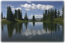
The State of Colorado is a state located in the Rocky Mountain region of the United States of America. The summit of Mount Elbert at 4,401m (14,440ft) elevation in Lake County is the state's highest point and the highest point in the entire Rocky Mountains. Colorado has more than 500 mountain peaks that exceed 4,000m (13,123ft) elevation. Colorado is the only U.S. state that lies entirely above 1,000m (3,28ft) elevation.
Depending on one's criteria, Colorado is home to about 55 fourteeners. While many are "walk-ups" which require only moderate fitness, many others require some degree of climbing skill. All require good alpine judgment.
Mount Elbert is the highest of the fourteeners in Colorado, and the high point of the Sawatch Range. It is located in Lake County, approximately 10 miles southwest of Leadville. It lies within the San Isabel National Forest. There are three routes up the mountain. The standard route ascends the peak from the east, starting from the Colorado Trail. The most difficult is the Black Cloud Trail, which takes ten to fourteen hours, depending on the pace.
Photography
If you have adventure-travel related experience in this region and would like to add content to this page, please contact us to learn how.
|
|||||||

