

General Information
| Languages : | Spanish (official), English |
| Currency : | Balboa (PAB); US dollar (USD) |
| Time Zone : | EST |
| Capital City : | Panama |
| Population : | 3 Million |
| Government : | Constitutional Democracy |
| Total Area : | 30,193 mi² |
| Climate : | Tropical maritime; hot, humid, cloudy; prolonged rainy season (May to January), short dry season (January to May) |
| National Holidays: | Independence Day, 3 November |
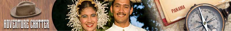
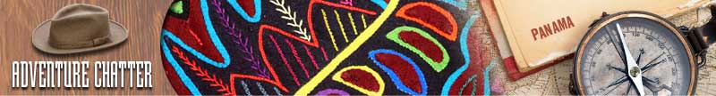
| Additional Info: | The culture, customs, and language of the Panamanians are predominantly Caribbean and Spanish. |
Destination Activities
![]()
![]()
![]()
![]()
Activity Details
Ecotourism
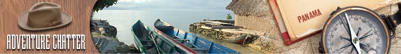
Panama is situated on an isthmus, though some categorize it as a transcontinental nation connecting the north and south part of the Americas. It borders Costa Rica to the north-west, Colombia to the southeast, the Caribbean Sea to the north and the Pacific Ocean to the south. Because of this unique location between two massive regions of the American continent, Panama offers some of the greatest diversity over other countries in Mesoamerica. It is home to many South American and North American species. It also has hundreds of islands as well as miles of protected coral reed creating a beautiful home for marine life. Panama is fast becoming one of the most exciting ecotourism destinations in the Americas and the world.
Darien National Park is a world heritage site in Panama. It is about 200 miles from Panama City, and is the most extensive of all national parks of Panama and is one of the most important world heritage sites in Central America. Its most common species include macaw, parrot, and tapirs. The harpy eagle also calls this national park home. It is noted for its incredible genetic value. The sheer beauty of the landscape and forest generally captivate visitors. Visitors will usually fly into El Real, the closest town to the park.
The Volcan Baru (also Volcan de Chiriqui) is the tallest mountain in Panama and is 11,398ft high. A dormant volcano just south of the Continental Divide in the western Chiriqui Province, it is surrounded by a fertile area of cool highlands drained by the Chiriqui and Caldera rivers. The towns of Volcan and Cerro Punta can be found on its western side, while Boquete is on the eastern flank. Due to its height and Panama's relatively short width, it is possible to see both the Pacific Ocean and Caribbean Sea from Volcan Baru's peak on a clear day.
Panama's western city of Boquete, just 30 minutes from David, the capital of Panama's Chiriqui Province, is nestled among the country's most mountainous region, at 1,200 meters. Try a canopy tour gliding through tree tops in the Boquete's one hundred year old forests above glistening rivers and waterfalls near the National Park La Amistad and close to the Baru Volcano (Volcan Baru). Boquete's healthy climate has prompted many to believe it is the secret to longevity since many native Boquetenos have lived well on past their one-hundredth birthdays.
Scuba Diving
Some of Panama's best diving is located on Isla Colon; the Bocas Del Toro often considered the hidden jewel of the Caribbean. The reefs have some the best preserved hard and soft coral in the world. The waters are inhabited by a wonderful variety of tropical reef animals including nurse sharks, sting rays and many types of crab and lobster. Diving is excellent all year round although the best times to come are March-May and September-October when the conditions are flatter so access to the remotest of dive sites is possible. Some dive sites are listed below:
Crawl Cay (65ft) - some of the best coral formations in the region, situated in the channel at the southern end of Isla Bastimentos.
Hospital point (52ft) - at the northern end of Isla Solartem, this dive has a reef that starts 6ft below surface and consists mainly of cauliflower and brain coral, and then gradually descends until it becomes a wall with a depth of 52 feet. The wall has numerous cracks and caverns, which are home to a wide variety of marine life.
Tiger Rock (100ft) - The farthest dive spot from Bocas, it lies just off the mainland, to the right of Zapatilla Cays. There is a large rock formation that stands above the surface, and descends well below 100 feet. Your dive will begin with a descent to approx. 35 feet, where there is a sandy shelf, littered with stones and coral.
Photography

If you have adventure-travel related experience in this region and would like to add content to this page, please contact us to learn how.