

General Information
| Languages : | Spanish |
| Currency : | Dominican Peso (DOP) |
| Time Zone : | EST +1hrs |
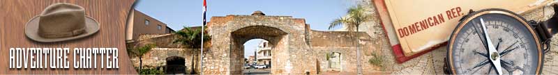
| Capital City : | Santo Domingo |
| Population : | 9 Million |
| Government : | Democratic Republic |
| Total Area : | 18,814 mi² |
| Climate : | Tropical maritime; little seasonal temperature variation; seasonal variation in rainfall |
| National Holidays: | Independence Day, 27 February |
| Additional Info: | The Dominican Republic is known for its exportation of Merengue music, a type of lively dance music consisting of a tempo of about 120 to 160 beats per minute. |
Destination Activities
![]()
![]()
![]()
![]()
![]()
Activity Details
Scuba Diving
The Dominican Republic is a tropical, maritime nation. Wet season is from May to November, with periodic hurricanes between June and November. Most rain falls in the northern and eastern regions. Diving is done year around, although the best time to dive is from June to September. For rainy days and multiple diving a 3mm full wetsuit is recommended.
Visibility can be expected to be between 50 and 100 ft. Some of the frequently spotted fish are the grouper and porcupine fish. Smaller life forms are abundant and makes for fantastic opportunities for the keen photographer. Magnificent and brightly-colored fan coral are a habitant of the gleaming reefs with illusive visitors like whale sharks, mantas, and the dolphins. In some areas, you can dive to underwater caves or shipwrecks that have been at the bottom of the sea for hundreds of years.
There are so many dive sites around the Dominican Republic, just a few areas are detailed below. Please feel free to add your experiences about the dive sites to this list, when you return:
Sosua Bay (north coast):
» Paradise Reef - Beginners can dive to a 40ft colorful reef wall. Advanced divers descend to a depth of 104ft. This also makes a stunning night dive, particularly when the octopi and squid come out to play. Also see the Dinoflagellates. See the fenomenon of this tiny half animal-half plant. With each fin stroke they leave a trial of bright green light behind.
» Airport Wall (80ft) - considered the best dive spot in the region, the reef wall begins at a depth of 40ft. The remaining is a maze of swim-throughs, caves, and schools of tropical fish. Inside one of the caves is a massive Elkhorn Coral, a rare animal that does not need sunlight to flourish.
La Romana/Bayahibe/Dominicus (south east):
» Catalina Island has The Wall ranging from 15-20 ft with sponges, large gorgonians and black corals hanging from the wall. You can do a second dive at the nearby beautiful Acuario or Gardens with an average depth of 30ft and many juvenile fishes and small critters inhabiting the isolated hard coral patches.
» Catalinita Island, a smaller island in the junction of the Atlantic and Caribbean Sea, has waters conditions that make it an advanced dive. Larger animals including different species of shark inhabit these waters.
» La Caleta National Underwater Park (south): The Hickory, 60ft wreck dive, is an intact treasure salvage ship sunk in the 1980s - it has a lot of marine life living on and within it.
» Boca Chica (south): has over 15 dive sites although some believe this part to be over fished and dived leaving little to view. Tanya V (72-110ft), wreck sunk in 1999; marine life beginning to flourish here.
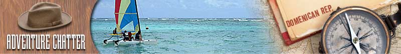
Rafting
Most rafting is carried out on the Rio Yaque del Norte, the longest river in the Dominican Republic, in the central mountain area. White water flows from the mountains through canyons and jungle and out to sea. It has class III to IV rapids (depending on season) including a 12ft drop named "Mike Tyson." The rapids flow through a narrow canyon and have some impressive drops. The rapids begin soft and gentle and transform into the larger class IV drops. There are a few tour operators that offer one day trips with guide and equipment to take on this challenge.
Hiking
The Dominican Republic has five separate mountain ranges, as well as various national parks and reserves found throughout the country. Most trekking trips include the Cordillera Central range, which includes Pico Duarte, the Caribbean's highest peak.
The Cordillera Central extends from the plains between San Cristobal and Baní to the northwestern peninsula of Haiti, where it is known as Massif du Nord. The highest elevations of the Cordillera Central are found in the Pico Duarte and Valle Nuevo massifs. There is a well-maintained system of trails leading up to the summit, with trailheads at several locations. The easiest access is from the town of La Cienega, near Jarabacoa. The trail is 14.4 miles to the summit, with a total elevation change of 6,490ft and a shelter 3.2 miles away from the summit. Tourist-friendly travel agencies in the town of Jarabacoa can help arrange trips from this trailhead, using mules in their employ to help lug food, sleeping bags and supplies for the overnight stay in the shelter. A few fresh water springs labeled "Potable" are along the trail, but water filters or purifying tablets are recommended. The vast majority of hikers travel by this route.
For the more adventurous, there is another trailhead northwest of the town of San Juan de la Maguana. These three-day (two nights) trips that end at the Ciénaga trailhead (or, for an extra day of hiking, back at the starting location) are run entirely by local Dominicans who cook the food you provide and help you camp along the way. Each night is spent in well maintained shelters, and due to the distance traveled, riding by mule-back is strongly encouraged. Far off the beaten path, it is highly unlikely that there will be anyone else on the trail until you merge with the trail from La Ciénaga. Although a Peace Corps worker has been helping to organize the trips, a strong command of Spanish is recommended for anyone that attempts this route.
Photography


If you have adventure-travel related experience in this region and would like to add content to this page, please contact us to learn how.