General Information
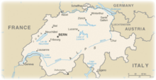
| Languages : | Switzerland is multilingual and has four national languages: German, French, Italian and Romansh |
| Currency : | Swiss franc (CHF) |
| Time Zone : | EST +6hrs |
| Capital City : | Bern |
| Population : | 7.5 Million |
| Government : | Formally a confederation but similar in structure to a federal republic |
| Total Area : | 15,942 mi² |
| Climate : | Temperate, but varies with altitude; cold, cloudy, rainy/snowy winters; cool to warm, cloudy, humid summers with occasional showers |
| National Holidays: | 1 August 1291 (founding of the Swiss Confederation) |
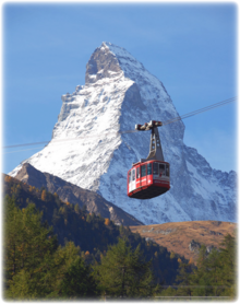
| Additional Info: | The most famous mountain is the Matterhorn in Valais and Pennine Alps bordering Italy. |
Destination Activities
Activity Details
Hiking
The Haute Route, (or The High Route or Mountaineers' Route) is the name given to a route (with several variations) undertaken on foot or by ski touring between Chamonix, France and Zermatt, Switzerland. First charted as a summer mountaineering route by members of the Alpine Club (UK) in the mid 19th century, the route takes around 12+ days walking running the 112 miles from the Chamonix valley, home of Mont Blanc to Zermatt, home of the Matterhorn. The route traverses below the summits of ten out of the twelve of the highest peaks in the Alps, and crosses several high passes. The highest pass is at 2964m (9,800ft).
This is a remote trek. Take a tent or sleep in a mountain hut. One or two nights could be spent in valley hotels to catch up on those hot showers. In general, mountain huts are open from mid-June until the first or second week in September. It is advisable to reserve a bed, particularly in the high season of mid July-mid August.
The early season (June-mid July) is the quietest and most beautiful but beware of old snow on the higher paths which could be icy and dangerous and would make an ice-axe essential. Zermatt is probably one of the most beautiful alpine villages in the world. Nestled just beneath the famous East face of the Matterhorn, the village is at 1600m (5,250 ft). Cars are not allowed in the village so the air is always clean and the streets quiet.
You would need to be comfortable with hiking 15 miles a day and climbing 4000ft. Acclimatization takes 3 or 4 days, so start slowly until your body adjusts to having 25% less oxygen in the air.
Climbing
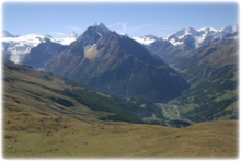
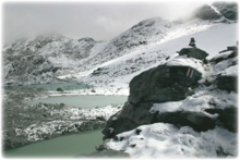
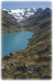
Switzerland comprises three basic topographical areas: the Swiss Alps, the Swiss plateau or "middleland", and the Jura mountains along the northwestern border with France. The Alps are a high mountain range running across the central-south of the country. Among the high peaks of the Swiss Alps, the highest of which is the Dufourspitze at 4,634 metres (15,203 ft), are found countless valleys, many with waterfalls and glaciers. From these the headwaters of several major European rivers such as the Rhine, Rhône, Inn, Aare, and Ticino flow finally into the largest Swiss lakes such as Lake Geneva (Lac Leman), Lake Zürich, Lake Neuchâtel, and Lake Constance. The most famous mountain is the Matterhorn.
The Matterhorn has four faces, facing the four compass points, the north face overlooking the Zmutt Valley, the south face Breuil-Cervinia, the east and west faces looking towards the Gornergrat and the Dent d'Herens, respectively, with the north and south faces meeting to form a short east-west summit ridge. The faces are steep, and only small patches of snow and ice cling to them; regular avalanches send the snow down to accumulate on the glaciers at the base of each face. The Hornli ridge of the northeast (in the center of the view from Zermatt) is the usual climbing route.
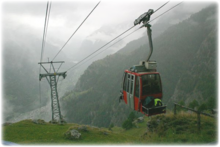
By modern standards, the climb is fairly difficult (AD Difficulty rating), but not hard for skilled mountaineers. There are fixed ropes on parts of the route to help. Still, because of the scale of the climb and inherent dangers, inexperience, falling rocks, and overcrowded routes, several climbers die each year. The usual pattern is to take the Schwarzsee cable car up from Zermatt, hike up to the Hornli-hütte (elev. 3,260 m/10,695 ft), a large stone building at the base of the main ridge, and spend the night. The next day the climber rises at 3:30 am, so as to reach the summit and descend before the regular afternoon clouds and storms come in.
Photography
If you have adventure-travel related experience in this region and would like to add content to this page, please contact us to learn how.
