General Information
| Languages : | Spanish (official), English, Italian, German, French |
| Currency : | Argentine Peso (ARS) |
| Time Zone : | EST +2hrs |
| Capital City : | Buenos Aires |
| Population : | 40 Million |
| Government : | Republic |
| Total Area : | 1,068,302 mi² |
| Climate : | Temperate; arid in southeast; sub-Antarctic in southwest |
| National Holidays: | Revolution Day, 25 May |
| Additional Info: | One of the main attractions is “The Train to the Clouds”. It is one of the three highest railroads in the world. It seems to be hanging from the mountains, and has some of the most dramatic scenery. |
Destination Activities
»»» Check out Special Destination: Patagonia
Activity Details
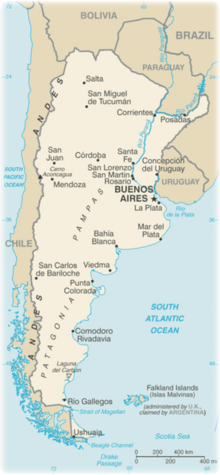
Argentina can roughly be divided into four parts: the fertile plains of the Pampas in the center of the country, the source of Argentina's agricultural wealth; the flat to rolling, oil-rich plateau of Patagonia in the southern half down to Tierra del Fuego; the subtropical flats of the Gran Chaco in the north, and the rugged Andes mountain range along the western border with Chile.
Trekking
El Calafate is a little village in Patagonia. It is situated in the southern border of Lake Argentino, in the southwest part of the Santa Cruz Province. This village is located on the southern shore of Lake Argentino and is the gateway to Los Glaciares National Park and Perito Moreno Glacier. The national park is the second largest in Argentina. Its name refers to the giant ice cap in the Andes range that feeds 47 large glaciers. The ice cap is the largest outside of Antarctica and Greenland. The northern half consists of part of Viedma Lake, the Viedma Glacier and a few minor glaciers, and a number of mountains very popular among fans of climbing and trekking, including Mount Fitz Roy and Cerro Torre.
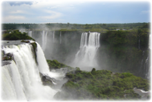
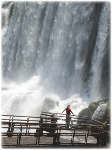
The Iguazu National Park is a national park of Argentina, located in the Iguazu Department, in the north of the province of Misiones, Argentine Mesopotamia. The Iguazu Falls are waterfalls located on the border of the Brazilian state of Parana and the Argentine province of Misiones. The falls divide the river into the upper and lower Iguazu. The thunderous cascades of Iguazu are one of South America's most popular, greatest, and most worthwhile sights. As more than 5,000 cubic yards of water per second roar over the evocatively named Garganta del Diablo (Devil's Throat) and other massive waterfalls, swallows flit through the mist beneath the overhang where ferns and mosses cling to their sheer volcanic walls. The park is more than the falls, though there are thousands of acres of well-preserved subtropical moist forest, crisscrossed by foot trails, plenty of colorful bird life, and even large mammals ranging from the gregarious coatimundi to the shy but predatory jaguar.
Saltastands out for its geographic and climatic heterogeneity, from the desert coldness of the Andes and the Puna to the subtropical heat of the jungle, with cool fertile valleys, mountains and rivers in between. The Province of Salta is situated in the Northwest of Argentina and it borders three countries: Chile, Bolivia and Paraguay. A trip round the Calchaqui Valleys, known as "La Vuelta a los Valles", is an unforgettable journey through a region that has witnessed a turbulent pre-inca and colonial history forged in dramatic surroundings, where the winds and the sun have sculpted its geography. Behind the incredible rock formations of its ravines and multi-colored hills, there are quiet villages whose adobe and thatch houses take travelers back in time to the distant past.
Climbing
The highest point above sea level in Argentina is located in Mendoza. Cerro Aconcagua, at 6,962m (22,834ft), is the highest mountain in the Americas, the Southern, and Western Hemisphere. It is located in the Andes mountain range. The summit is located about 3 miles from San Juan Province and 9 miles from the international border with Chile. It lies 70 miles west by north of the city of Mendoza. Aconcagua is one of the Seven Summits.
Aconcagua is a preferred destination due to the physical and psychological demands it poses to climbers, its climate and the beauty of the surrounding scenery.
Aconcagua is bounded by the Valle de las Vacas to the north and east and the Valle de los Horcones Inferior to the West and South. The mountain and its surroundings are part of the Aconcagua Provincial Park. The mountain has a number of glaciers. The most substantial are the north-eastern or Polish Glacier and the eastern or English Glacier.
Aconcagua is technically an easy mountain if approached from the north, via the normal route. Although the effects of altitude are severe (atmospheric pressure is 40% of sea-level at the summit), the use of supplemental oxygen is not required. The second most frequented route is the Polish Glacier Traverse route. This approaches the mountain through the Vacas valley, ascends up to the base of the Polish Glacier then traverses across to the normal route for the final ascent to the summit. The routes to the peak from the south and south-west ridges are more demanding and the south face climb is considered very difficult.
Before attempting, climbers need to purchase a permit from the Aconcagua Provincial Park authority in Mendoza. Prices vary depending on the season. It is common to spend at least one night in Confluencia (campsite at 3,380m [11,090ft], a few hours into the national park) while trekking to base camp in order to acclimatize properly. Summit attempts are usually made from a high camp at either Nido de Condores or Berlin. Although Berlin is closer to the summit, many climbers find that they rest better at Nido and are able to make up for the lost time. Some well-acclimatized climbers also pitch their high camp even further up the mountain, at Piedras Blancas (~6,000m) or near Independencia (~6350m).
Boating
There are some great white water adventures to be had outside of the Patagonia region of Argentina like on Rio Mendoza, a river in the province of Mendoza, as well as many others. Unlike North America, the best months for rafting in South America tend to be in the months of September to February, which are the spring and summer months in the southern hemisphere.
Rio Mendoza: take on the Mendoza River in Potrerillos, with its class III-IV rapids and lose yourselves in the natural landscape. Watching the mountains and the desert vegetation around you, breathe the pure air, and rolling waters full of speed.
If you would like to expand on this section please contact us.
Ecotourism
The Iguazu National Park is a national park of Argentina, located in the Iguazu Department, in the north of the province of Misiones, Argentine Mesopotamia. The park contains one of the greatest natural beauties of Argentina, the Iguazu Falls, surrounded by the subtropical jungle.
The Train to the Clouds, offers a view to the stark contrasts of the province of Salta. It begins in the city of Salta city ascends to San Antonio de los Cobres, reaching an altitude over 4,000m.
Cueva de las Manos (Spanish for Cave of the Hands) is a cave located in the province of Santa Cruz, Argentina, 101 miles south from the town of Perito Moreno, within the borders of the Francisco P. Moreno National Park, which includes many sites of archaeological and paleontogical importance.
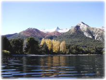
Nahuel Huapi National Park is in the provinces of Neuquen and Rio Negro, in Patagonia, in the foothills of the Andes mountains.
From Puerto Madryn daytrips run to Punta Tombo. This is a penguin colony where you can walk among thousands of penguins between the months of October and March.
Ischigualasto is a geological formation and a natural park associated with it in the province of San Juan, north-western Argentina, near the border with Chile. The Ischigualasto Provincial Park is located in the north-east of the province, and its northern border is the Talampaya National Park, in La Rioja, both of which belong to the same geological formation.
Photography
If you have adventure-travel related experience in this region and would like to add content to this page, please contact us to learn how.
